Quiet weekend at home

|0 comments
No hike this Sunday, unfortunately. Despite the fact that I'm still fighting the remnants of a cold away, I was going to push ahead and hike anyway-- I figure a little walking never hurt anyone, and this time it's not as if I had an upper respitory infection like I did with the Lewis & Clark trail. But despite sleeping on a drowsy allergy pill and having been awake for more than 18 hours (I had to get up at 6am this Saturday to go to an early childhood education conference, at which I was also presenting), I slept very badly, waking up at least twice (the only ones I know for sure are 4am and 6am, because I looked at the clock). The forcast was for rain, though of course it hasn't rained yet all day. Strange weather today, actually. It was chilly, but not really cold, but it looked like the most wintery day we've had so far. Cloudy in the sense that the sky and air is one great big expanse of gray so that you can't tell where the horizon ends and the sky begins sometimes, where it looks as if it must be misting, but there is no precipitation. So in the end, I decided to sleep in a little bit and then headed to the London Tea Room for lunch and a nice pot of my favorite tea blend there-- the 5th of November. Black and smokey like a campfire, really hit the spot.

I don't want the changing weather to affect my hiking. While I'm not really a winter person (fall is by far my favorite season), I don't see that unless it is really unbearably cold and windy, I should stop. The problem is that I need the proper dressings for a winter hike, and I'm not sure what that is yet. I hesitate to go to an outdoorsy shop because I don't want a salesperson pushing expensive gear and coats on me that I cannot afford and may not need. I imagine it is mostly a matter of learning how to properly layer. I have some long-john type underthings that I bought for when I studied abroad in Austria, though I have to find them. Heavy socks are an easy thing to get, and I still need to get off my butt and figure out if those hiking shoes are mine or need to be returned. What I *don't* know is if my winter coat is appropriate-- will it be too heavy and uncomfortable once I start moving and working up a sweat? Should I get something in between a fleece jacket and winter coat, and wear my regular shirt and long-john shirt under that? I have no idea, but I suppose a little bit of trial and error will do me well-- take some shorter winter hikes and see how my winter coat pans out. I don't really have the money to spend on anything too fancy, but I'm going to look around and see what my options are.

Maybe next weekend it will still be nice and I can go on a hike. I really want to try the View Valley Glades hike... though it doesn't come up when I search for it on mapquest. Instead, Victoria Valley Glades shows up in the same area, but is a completely different conservation area that isn't in the 60 Hikes book at all. Confusing. But I have a pretty good idea of how to get there now (both are near Hillsboro, Missouri), so if my luck is set next weekend, I'll check one of them out.

Hilda Young Conservation Area & Powder Valley Park

|2 comments
Even though we are about to begin the second week of November, the weather has been extremely warm (though with St. Louis weather, that hardly surprises me) at near 80 degrees today! So of course I couldn't pass up the day for hiking, especially after an especially quiet and lazy weekend at home. Originally it was going to be another group hike, but in the end it was just me and Allison, and a promise to meet the other girls at the London Tea Room later that afternoon.

I wanted to try the Hilda Young Conservation Area because it sounded gorgeous and seemed kind of out of the way, though 60 Hikes in 60 Miles recommended it as a good spring and winter hike. However when we arrived, not only were there plenty of cars already parked in the small lot (it seemed like mostly hunters and fishers?), but a sign on the board said that the main trail was closed because the bridge was out. I'm not sure when Missouri Conservation plans on fixing this, but hopefully by next spring the whole trail will be available to hike. I will be returning to this trail again in the future to complete the entire thing.

Despite this, Allison and I took the hike down to where the bridge was out, just to take a look, then began hiking back down the closing side of the loop that would lead us towards the pond and the parking lot again, a nice short loop. I was very glad, however, to have the 60 Hikes book with us, because the author described a small mown path that we could take that would follow LaBarque Creek and give us a look at the bluff where the pine plantation was (where the full hike would have taken us had the bridge been in working order). It was very pretty and gave us just the extra bit of hiking to make us feel that we hadn't missed something by coming while the bridge was out. Between the very pretty light woods, the open medows with tall grasses, the creek, and the easy to see, wide grassy trails, the hike was pleasant, very pretty, and really relaxing. The trail was very well marked (for once!) with easy to see sign-posts and little markers with hikers on them, and also had some informative signs along the way near benches explaining how the planting of certain trees was working to prevent erosion. Despite the large number of cars in the parking lot, we didn't see anyone on the trail or spur except for a man fishing at the pond when we started. There was some noise from the nearby roads that never quite seemed to disappear, but it wasn't too bothersome-- also, I imagine as the hike goes on further past the creek, noise might be less of a concern. Overall I really liked the feel of this area, small and kind of intimate, and the book promised some really good sights further on up the trail which I will definitely return to explore. The warnings about hunting season made me slightly nervous, but the signs on the trail seemed to promise no hunting within those limits.

Afterwards, because it was on our way back, we stopped briefly at Powder Valley Park in Kirkwood and did their shortest 2/3 of a mile hike on the Broken Ridge Trail. This was a very different walk for me because the paths were paved, but it was actually very beautiful, and completely surprising to find such an expanse of wooded walks in what seems like the middle of the suburbs. The path was crowded with families and children, but it is very family friendly so that was to be expected. The trail actually had some pretty steep inclines, and was very peaceful and a very short but pleasant and fulfilling walk. If I have more time, I would love to go back and do the other two short trails at Powder Valley. It seems like a nice place to go for a stroll with friends or jogging.


Lone Elk Park

|2 comments
I have been waiting to try out the trail at Lone Elk Park because my good friend Allison has been wanting to do it with me. Today was the perfect opportunity. My roommate Ashley and friend Tanya also joined us! This opened up an entire new kind of hiking for me. The trend that I've represented on this journal is of me hiking alone. When I'm alone, hiking is an experience that I cannot explain. It seems really sappy and cliched to talk about it out loud, but being alone with just me and a really beautiful surrounding is so peaceful and calming. I like being alone, having the me-time. It's introspective, or on the other hand I don't have to think about anything at all except my next step and the view.

But hiking with three other people was actually really fun. It was hard to get a good pace down at first. I tend to either walk very very fast, or very slow when I'm looking at the scenery. We took turns being trail leaders, but in a natural way-- when one person lost the trail (I'll get to that in a minute), we would all stand together and work to find it, sometimes someone would skip ahead to check out a possibility, and someone new would usually start in the front, the rest of us behind. We also fooled around a lot, which is usually what annoys me about other people on the trails I go on, but was actually refreshing to take a little less of a serious approach to hiking. It was fun to talk, see where the conversation took us, or sometimes just walk in comfortable silence. There is always something to talk about though when you think you're lost or about to be impaled by elk. It was fun to take ridiculous pictures and romp around! I really, completely enjoyed myself, and could definitely see me going on these outings more often. It's definitely a very different experience, but not in a bad way at all!

So, Lone Elk Park. We took the only trail that is there, the White Bison Trail, which is about 3.25 miles around a lake. This was nice because it was a different vista than I've been doing lately-- trading out my rocks and rivers for deep woods and lake overviews. Some of the trail is a lot less wild than others I've been on, following the road that drivers take around the lake to view the elk from the safety of their vehicles. These cars then proceed to stare at you strangely because it does look indeed like you are somewhere you are not supposed to be-- it is not widely marked through the park that there is a hiking trail.

Actually, the trail itself is badly marked. I would NOT recommend this trail for a late fall hike. There were so many leaves on the ground that most of the time the trail was completely unreadable, and the trail is seriously lacking in signs or posts-- some of the posts that were on the trail had markings that had been worn or actually taken off and were completely bare, while other signs that seem to have been meant for trees were either fallen on the ground or lacking actual arrows. We lost the trail about half the time we were one it, and only with stupid luck of pushing forward despite not knowing which way to go did we find the trail again. The visitors office was out of trail maps, and the ones I had in my 60 Hikes in 60 Miles was not detailed enough to be helpful. We worked extra hard climbing up incredibly steep (and slippery) inclines that were probably not the trail at all, but it was so hard to tell that our only hope was to keep pushing forward.

The hiking trail gets you closer to Elk than I actually thought it would, or possibly closer than I needed to be! There are signs posted telling you when to be careful of mating season, and to always keep a safe distance of 100 feet from the animals. This would be good advice, except twice on the trail, groups of elk, both male and female, were actually blocking the trail. Giant creatures, beautiful to watch, but regardless blocking the visible trail. The first time was easier-- we were about to cross and follow the road to the second part of the trail anyway, so we were easily able to not interrupt the elk, but also get a really good view of them from where we were. They barely paid attention to us at all, eating and resting under the trees. The second time the elk blocked the trail was NOT as easy. There were quite a few large males, and we had to walk up a steep hill towards the road above us, walk over the ridge and carefully try to pick up the trail on the other side of the elk. They didn't seem to mind us too much (obviously the animals in such a park are completely used to people being around them, there was even a deer that was within a few feet of us that didn't move while we tried to maneuver our way through the weeds), but did follow us watching in case we got too close. obviously one of the best parts about this trail is getting so unbelievably close to these giant, amazing animals.

I would love to revisit this trail in the springtime and see if it is any easier to navigate, since the stress of feeling completely lost every 15 minutes started taking it's toll after awhile. Obviously the best part of this trail was getting so incredibly close to the animals, which makes up for the incredible amounts of deer/elk poop. The lake was beautiful, and while though sometimes the cars driving by on the road were slightly annoying, some of the trail was also secluded (and the road helped us get our bearings more than once). I had a really good time, and it was pleasant to do something different.


Purchases!

|0 comments
REI was having a sale, so I thought I'd treat myself to some hiking gear. My sneakers that I usually wear hiking are at least a couple of years old, and don't seem to have the traction or support I need in some of the more difficult trails. I want to keep this up more than anything, so hopefully the money I spent will remind me that I better get out there!
   Buying hiking shoes is not easy. The store was insanely busy, so while I was helped quite a bit, I still didn't get all the advice I probably needed. I ended up buying a pair of women's Vasque hiking boots on sale. Even though I was told at first that these shoes were better for narrow feet, the other pair that the woman brought that were better for wider feet never seemed to fit quite right despite the two different sizes I tried on. The Vasque shoes were the ones that felt the best at the time, and I walked around in them and went up and down their fun fake rock to try them out. I brought the Vasque shoes home and haven't worn them around quite enough yet to gauge whether they are right for me. It's hard to tell because I'm not sure if the shoes simply don't fit right or if I'm not wearing them. After wearing them around the house a little, the top arch of my foot hurt, but I think it was because I tied the laces too tight. It also felt strange walking around in them, but I am not used to wearing a shoe with a high ankle like that. What I need to do is hanker down and actually wear them around the apartment every night I can for a week, and then make a decision. It would be a shame to have spent a good sum on a pair of shoes that didn't fit just right-- I'd hate to be caught on the trail with blisters!

I also may have bought some socks there because I realized that perhaps one of hte issues with the shoes was that I was wearing little girly ankle socks with them, and those are hardly the right socks for hiking at all, much less for shoes with high supportive ankles. These, while strangely costly (hence the reason I only bought one pair... I'm sure I can find appropriate socks at Target or something), at least will give me the feel I need to decide whether I will be keeping these shoes or bringing them back. I maaay be overthinking this, but it really is a hard play to call.


sorry about the terrible pictures.

Castlewood State Park

|0 comments
This was my first hike since Lewis & Clark, after which I came down with both a respiratory infection AND the flu, had to take a week off work, and was generally miserable. But I am glad to be back on my feet!

After my weekend roadtrip got pushed back, I decided not to let this fantastic fall day go to waste. The trail I was on was crowded with lots of people and families, which I'm not always crazy about, but granted this was a Saturday afternoon, and the first sunny day we've had after what feels like almost two weeks of straight rain. It was sunny, cool but not cold, and the fall colors were breathtaking... can't hold it against people to want to take advantage of that! I had no trouble parking or anything, and there were still moments of my hike where I was alone.

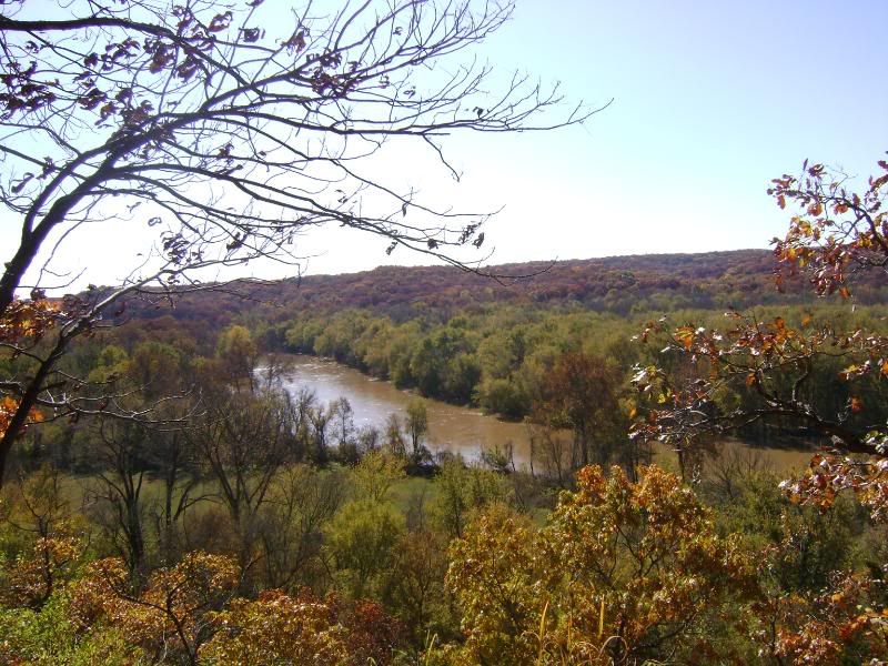
This hike was very similiar to the Lewis & Clark trail hike I did a few weeks ago in the sense that it had a variety of scenes, both rocky bluffs looking out over hills of trees and  a river (the Meramec River this time), as well as long walks through the woods. However the second half of the Lewis & Clark trail was really more deep wood walking, while this trail had a more relaxed trail, very flat, that just followed the river (and was very muddy, but again the rain is to blame there). There was really almost no hard parts, except maybe one incline right at the very beginning, with all the steeper descents helped along by wooden steps leading down to the river banks. There is a mix of outlooks that are both free rocks and then platforms as well. The trail itself is mostly rocks on the bluff part, which with all the leaves on the ground made it a little hazardous for a clumsy person like me, and the river trail is mostly packed dirt (or lots and lots of mud in this case). The scenic outlooks over the Meramec River and the fall foliage was absolutely beeeautiful, and I would definitely recommend this time of year for this hike.

My main problem was the lack of trail markings. The trailhead for the Scenic River Trail was actually to the side of the parking lot and then right when you start, I couldn't figure out if there was a trail leading to the right as well as left before noticing the red marker nailed to a tree on my left showing where to start. There weren't too many problems with keeping to the trail on the bluffs section, except for a few times were it looked like the trail split off-- usually both split offs ended up joinin back together within a minute, and a few signs mentioned which trail was the bike trail as opposed to the hiking trail. However once you get to the trail that follows the river, you cross into a large open field and a crossroads that I found incredibly confusing. Going to the left, I find a sign pointing to a different trail, and the red marker pointing back the way I came. Another sign points out the parking lot. Then to the right, the trail through the field continues back to the river through the woods, with no sign saying which trail it was, though a little way in there was another red marker that COULD have been orange. The map that I got at the park office and the map in the 60 Hikes within 60 Miles book were of no help because it was really hard to tell where you were on the trail. None of the trail maps I found along the way had markers to say where you were or a name of the trail, so I could only assume I was still on the Scenic River Trail, or at least one of the spurs that were described in my book. Then at the end of the trail (I kept following ht river), I was confused because I hit the actual road again, and went under a bridge and walked along the road until I found the parking lot I'd started in. So super confusing, and even a couple that I stopped had no idea what trail they were on or where they needed to go.

Overall, despite the confusion, it was beautiful and a great hike. The views were fantastic, the walk was relaxing and I had a great afternoon. I didn't want to miss the last chance I might have to enjoy not only the fall weather,but he changing of the leaves.


Lewis & Clark trails- Weldon Springs Conservation Area

|2 comments
Today I bit off a little more than I could chew with the Lewis & Clark trails in the Weldon Springs Conservation area. The Lewis & Clark trail runs as one trail for about 2 miles or so, and then split off into two separate trails; The Clark trail runs a total of 5.3 miles (including what you've already completed) and the Lewis Trail runs a total of 8.2 miles (also including what you've already done). I was positive I could pull off the 8.2 mile trail even though I can't remember if I've hiked that long of a hike. It  certainly took most of hte day, and there were times I got tired and actually found a tree or bench to sit/lie down on and close my eyes for a bit!  Also, the trails do not break apart as soon as the map or my book had me believe, so I spent a lot of time worrying if I was doing the right thing and had somehow missed a trail. Also, picking up a map at the Weldon Springs Conservation Area lodge is not worth it... the one in my 60 Hikes Within 60 Miles of St. Louis book was just as good.

The book descripes the difficulty of this hike as moderate, which is certainly true. While the first mile or so is very flat and easy going (I wasn't so happy that you could hear the traffic from MO 94 for awhile there, but it's not that bad), the long hike has lots of terrain types to worry about. On the way up to the best scenic outlooks was a steep hill climb over rocks and loose stones that took my breath out of me for awhile, and there were a lot of steep descents throughout the trail. You kind of went up and down the bluffs, climbing up steepish hills to get to the views and then twisting back down into the hollows and valleys to bottom out on level ground, and then back up again. Near the end of the hike you end up mostly on flat ground down in the valley with only a few climbs, none of them worth much trouble, so there's quite a bit of this hike that is just a pleasant walk in the woods. A walking stick did me some good though on some of the more steep inclines. Also, near the trail splitting point, I had a lot of trouble keeping the trail in sight when it went into a dry riverbed. Luckily a hiker passed by at that very moment and showed me where it picked up again on the other side.

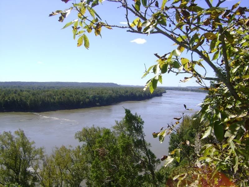
The best part of this hike is the views it offers from the bluffs overlooking the Missouri River. I kind of wish I was brave enough to hike the trail clockwise like the author of the book does, because those views would be brilliant to save until the end of your hike. However going by the trail markings, you get most of them first and then the rest of the hike is forested. The views are breathtaking. You look for the little spurs that lead you out onto rock outcrops, and the Katy Trail is below you (you can sometimes hear families that are walking down there) with the Missouri River stretching out on either side and a wide expanse of forest across from you. This is where I sat and had some lunch and sunned and generally enjoyed the absolute gorgeous beauty of the landscape and the silence of the surroundings. I was tempted to actually just spend the day right there on that bluff and then hike back the was I came when it was time to go home. If I had had a book, I might have! Also on the descent from the cliffs into the wooded valleys below, I saw three deer pretty close up (before I came bumbling along), and that was awfully exciting.

For someone not used to this length of hike, I admit the trail seemed to go on FOREVER. I was sore and asthmatic by the end, but felt very accomplished. I cannot say how happy I was by the end of the trail to hear the familiar sounds of traffic from MO 94 letting me know that I was near the end. I think knowing now how long 5 hours actually is to walk, I'd be able to better concentrate on the trail itself, because this time I was so tired and tryin to figure out where on the trail I was that some of the last couple miles seemed all the same. I took this hike on a weekday afternoon and ran into eight people (three of them with dogs) during my whole trip, so for most of hte stretches I was completely alone without any background noise from other hikers, which was nice. One thing I did not like was that while the trail was marked really well for the first 3 or 4 miles (with "trail" signs and mile markers, which was nice), once you got onto the Lewis Trail, the mile markers seemed to stop and the trail markers were fewer.

I would like to retake this hike (perhaps the shorter one this time) once the leaves start changing, because I can't even imagine how gorgeous those scenic outcrops will look! Also in the winter, you could probably get some great views o the river from places on the trail you normally couldn't because the trees would be without leaves. Definitely a great hike, but I know I'll be feeling it in the morning!


Giant City Nature Trail / Alto Pass Overlook (Carbondale, Illinois)

|0 comments
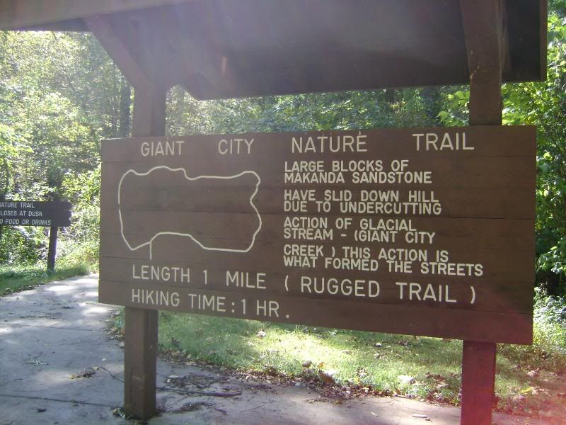
Was lucky enough this weekend to go to a park I would not usually get to see because it is more than out of my usual driving range. Giant City National Park is near Carbondale, Illinois. We were lucky that we were even able to go because of the immense damage the park suffered in May due to hurricane-like conditions, but luckily we had a friend who was able to guide us to a usable entrance (that I never would have found).

Hike itself was absolutely lovely. It was the weekend, so it was a bit crowded at times for my tastes with families, but it was shady and beautiful and not quite like a landscape I've hiked before due to the sandstone rocks and cliffs all over the place. While there was one main trail, there were so many little alternate paths you could take by climbing up rock paths, going through little alleyways between giant rocks, and having the option to climb here and there over rocks and up paths. The trail itself therefore is a mixture of absurdly easy and slightly more treacherous.  It wasn't a long trail, but between climbing and resting to take in the scenery, it definitely encourages hikers to take their time. NOt a huge fan of the gravel type trails, but overall I had an amazing time on this little trail.

Also we visited the Alto Pass overlook, which isn't so much a hike, but there is a wonderful rocky outcrop overlooking the hills of southern Illinois, which would be even more amazing with the changing leaves in a few weeks, I bet. You can also see the country's biggest cross some miles in the distance. There is a little stoney staircase that leads down to a path, but I was unable to take the little trail and see where it went, but definitely worth the look because the stairs, while a little scary looking, are really cool, and there are some fun rocks to climb.

Had a great time, and there are more pictures of the trip to Carbondale on facebook, but these are really the bulk of them. It was kind of a different feel hiking with other people for once instead of on my own, but it was really fun. I'm glad we had a tour guide to show us around, and I'm really glad I got to experience a park that is out of the St. Louis area!